
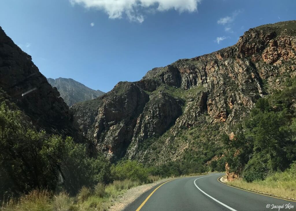
Meiringspoort

What is the difference between a “poort” and a “pass”? Whilst I knew that both were a way through mountains, I couldn’t decide on the difference. Mountain Passes of South Africa states that “Poorts are different to passes in that they usually have very gentle gradients”. The Collins dictionary defines a poort as a “steep, narrow mountain pass, usually following a river or a stream”. The Oxford Languages dictionary defined it as “a narrow pass, through mountains”, highlighting the fact that it comes from the South African Dutch word meaning ‘passage’, from the original Dutch word “poort” meaning ‘gate’. The Merriam-Webster dictionary says it is “a pass between or across mountains”, whilst Dictionary.com says it’s “a steep, narrow mountain pass, usually following a river or stream”. The difference between that and a pass? Well, I get the sense that a ‘poort’ is generally lower. Beyond that, it’s anyone’s guess! Personally, I believe that the words are interchangeable, and that “poort” is simply the Afrikaans version of pass, together with ‘pas’. Once the word ‘poort’ was used in a name, it stuck – like Meiringspoort.
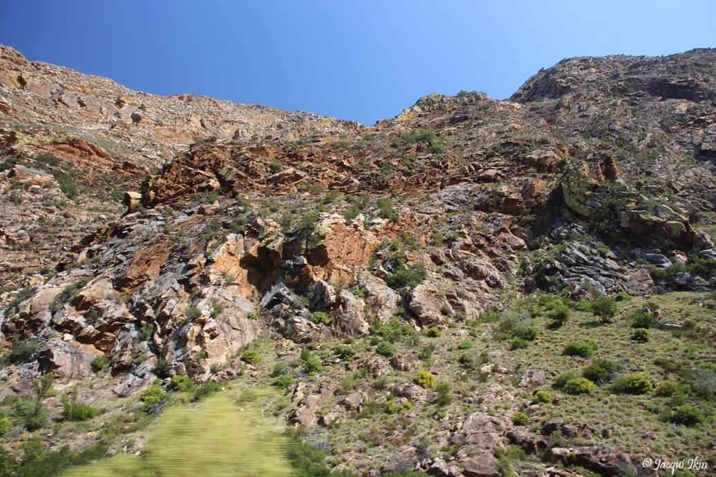
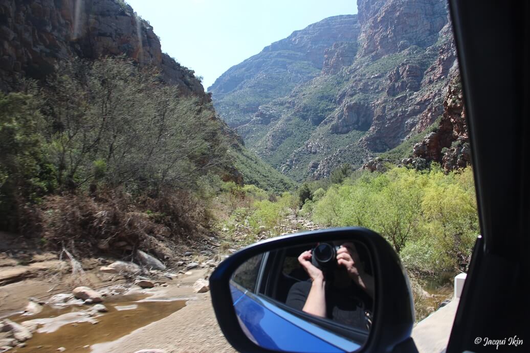
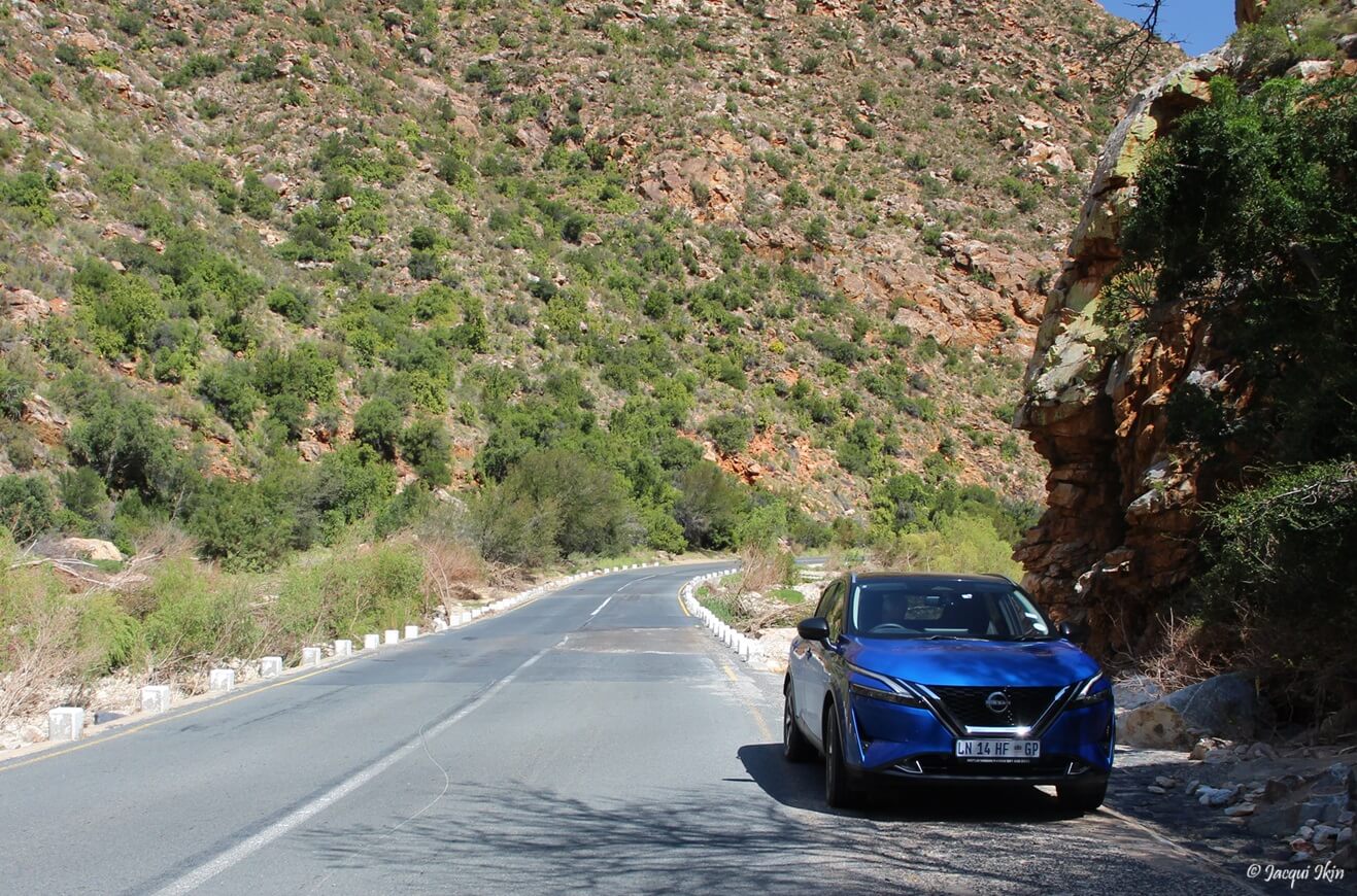
There are basically two roads between Oudtshoorn and Prince Albert. The R328 which has the Swartberg Pass (featured last week) and the N12 / R407 which is via Meiringspoort, the subject of today’s article… Meiringspoort is named after Petrus Johannes Meiring who, in 1848, made the first recorded transit of the poort. It runs through a gorge as a 25 km road, crossing the Groot River 25 times.
Meiringspoort is a great chasm in the Swartberg Mountains. The wool farmers from the Great Karoo (north of the Swartberg) had a huge challenge getting their wool to Cape Town. At that time, there was no road through the Swartberg mountains. People in George, Mossel Bay and Oudtshoorn wanted to trade wood, furniture, potatoes and sweet potatoes with those to the north. By 1854 the government had received many petitions for such a road, and Andrew Bains and Sir John Molteno led an expedition in August 1854 to see whether it was feasible.
On 31 March 1856, a meeting was held in George to petition that a road through the Swartberg mountains be urgently commissioned. After a horseback survey, they were of the opinion that a rough ‘boer road’ could be built at a cost of between £3000 and £4000. They were warned however that such a road would be subject to frequent washaways. A properly engineered road would, on the other hand, cost in the region of £50,000. An amount of £5000 was eventually allocated and construction of the ‘boer road’ began in August 1856. There were 20 labourers and a supervisor. There were many complaints about the supervisor, and he was replaced by Adam de Smidt. The road was finished in 1858. During the operations, Thomas Bains (Andrew’s son) called at the site in his position as Roads Inspector. The road was officially opened on 3 March 1858, and the first freight of wool from the interior was dispatched on the same day as the opening of Meiringspoort.
The final cost of the build was £5018. It is said that it took an average of 93 workers per day, with an overall 223 days of work. As predicted, the road was frequently damaged by heavy rains. In 1885 a flash flood destroyed most of the road, and Thomas Bains was called to assist. Although at the time he was busy with the Swartberg Pass, he saw to the restoration of the road by 1886 – redirecting its course to eliminate many of the river-crossings.
Meiringspoort was well used, and over one million kilograms of wool was transported through and sold in Mossel Bay (as reported in The Beaufort Courier 3 June 1870). This represented one eighth of the total wool-clip from the Cape. By this time the Government had a strategy to provide work for the many unemployed during the Great Depression of the late 20s / early 30s, and £10,000 was made available as part of this to refurbish the poort. Many of the drystone walls and supporting stone bulwarks built at this time are still visible today. During this time, three shillings and six pence were the pay for a day of hard labour.
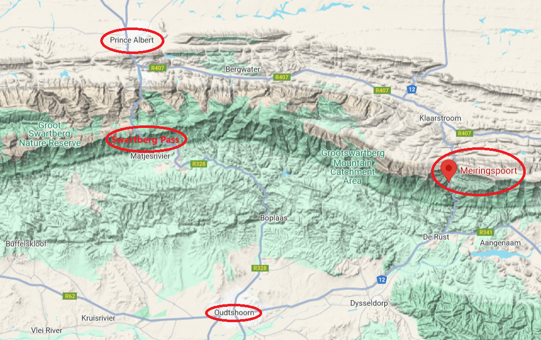
In 1945 a decision was made to replace the drifts with causeways. The project began in 1948 and completed by 1953 at a cost of £14,928. These strips of concrete assisted in limiting the damage caused when there were large storms in the area. In 1961 the option of tunnelling though the Swartberg mountains was explored – but proved to be too expensive. In 1964 there was a petition to tar the road, and in an attempt to maintain the beauty of Meiringspoort, as little blasting as possible was planned. As a result, building materials had to be trucked in – specifically dolomite from Renosterkop (near Three Sisters) which is about 180km away. Stone walls were built to maintain the character of the poort, and 480 men from the Ciskei and the Transkei were brought in to do this. This increased the cost to a final total in 1973 of around R1.6 million – and the tar road was finally opened on 3 August 1973. A brilliant young civil engineer, Roy Petersen was responsible for the entire upgrade. In 1988, when some of the worst floods in living memory took place, his tarred road, causeways and stone reinforcements held, with only minimal damage incurred.
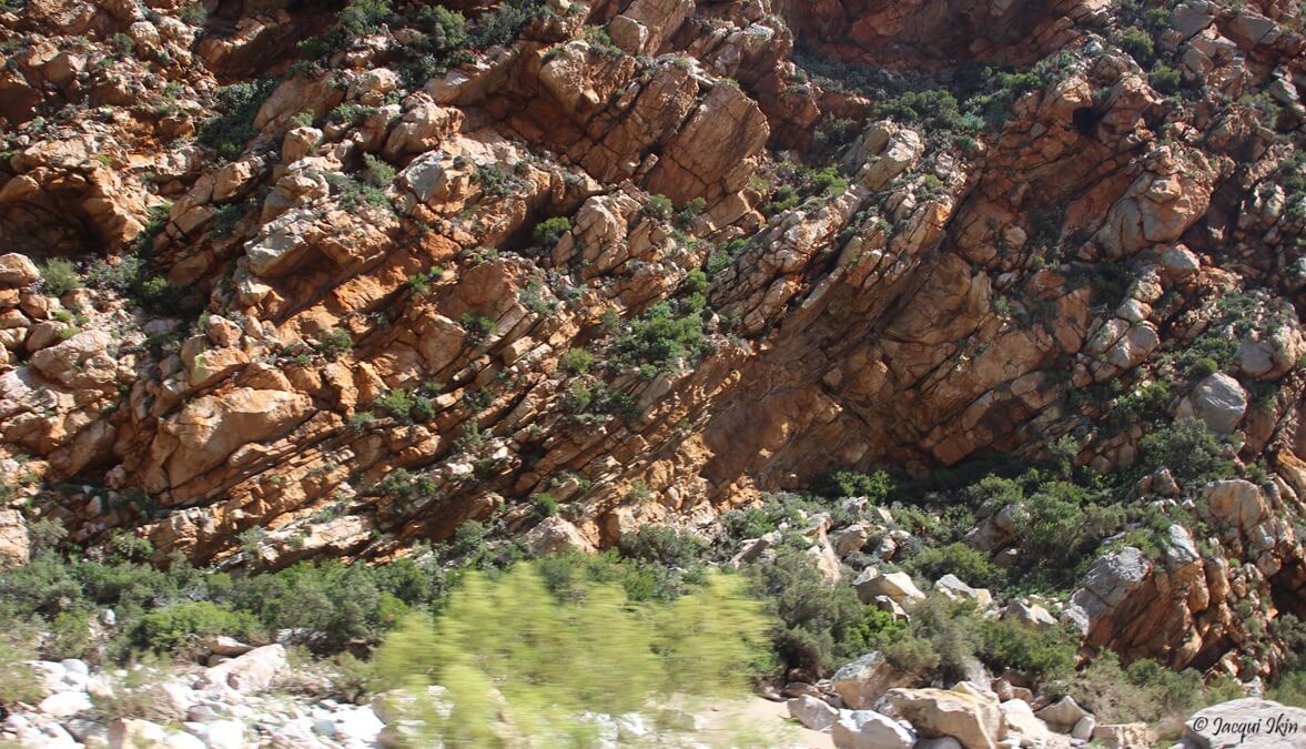
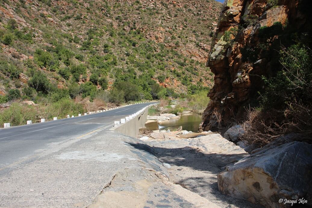
Meiringspoort took shape about 250 million years ago – when Africa was still part of Gondwanaland. It is a humbling experience to know that you are surrounded by and touching rocks that ancient. I highly recommend that you take the scenic route and experience Meiringspoort – unless of course there has been heavy rainfalls, when the area becomes dangerous and should be avoided.
Jacqui Ikin & The Cross Country Team
